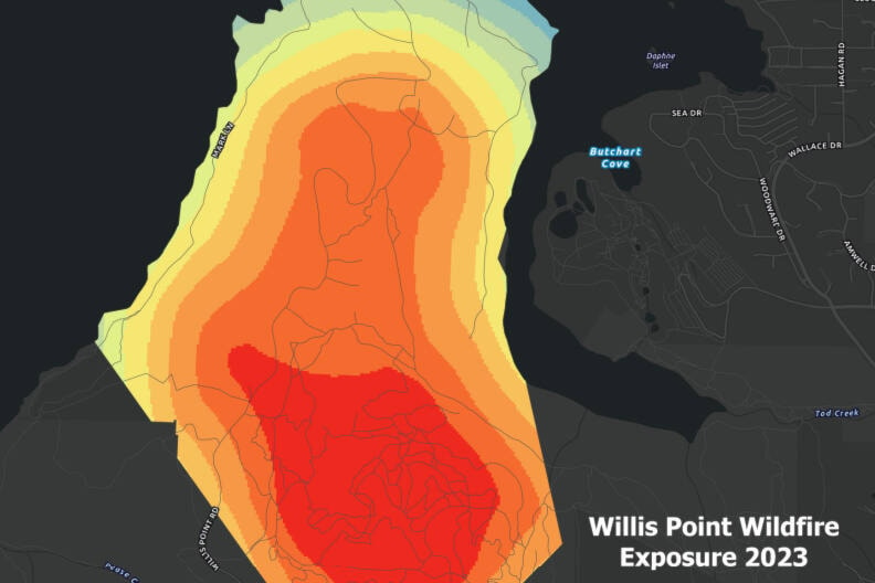
Photo: (CRD map). Retrieved from saanichnews.com
Excerpt from saanichnews.com
Ten new wildfire risk maps will help those living in more rural parts of the Capital Regional District understand their risks.
While wildfires are a natural process in fire ecosystems, they cause harm in communities, reads an Oct. 3 CRD statement announcing the maps for Juan de Fuca, Salt Spring Island and Southern Gulf Islands.
“Our communities are nestled in a rich natural environment with mixed forests and vegetation that have different levels of risk due to changes in stewardship and fire suppression practices over time,” said Paul Brent, chair of the electoral areas committee. “As we continue to live with climate change we need to work together with landowners and community partners to prevent and be prepared for wildfire.”
Hazard fuels – vegetation that throws embers or produces intense heat when burned – are a potential source of harm because they allow fire to spread quickly and put homes at risk.